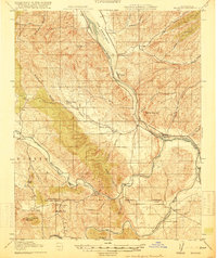
1919 Map of Bradley
USGS Topo · Published 1919About this map
The Salinas River valley serves as the primary corridor for development in this South Coast Range landscape, where the Southern Pacific Coast Line railroad links rural outposts like Getty Siding, Wunpost, and the town of Bradley. To the west, the San Antonio River and Nacimiento River meander through a series of canyons and broad valleys, including Hames Valley and the Pleyto region. This era of settlement is defined by widely spaced ranching operations such as Lynch Ranch and Branch Ranch, supported by a network of one-room schoolhouses like Hames Valley School and Bee Rock School. The crossing of the Monterey Co San Luis Obispo Co Boundary Line highlights the area's remote location at the intersection of two central California counties, where life centered on seasonal water sources like Los Lobos Springs and Pleyto Well.
Find a feature on this map
43 named features on this map. Tap any name to fly to it.
Don’t see what you’re looking for? This feature index may not catch every label — zoom into the map to look around manually.
Map Details
Editions of this 1919 Bradley Map
4 editions found
Other maps of this area

1912 · San Ardo
USGS Topo · 1:31,680

1915 · Priest Valley
USGS Topo · 1:125,000

1919 · San Miguel
USGS Topo · 1:62,500

1919 · King City
USGS Topo · 1:62,500

1919 · Bryson
USGS Topo · 1:62,500

1919 · Paso Robles
USGS Topo · 1:62,500

1919 · Bradley
USGS Topo · 1:62,500

1919 · Adelaida
USGS Topo · 1:62,500

1919 · San Simeon
USGS Topo · 1:62,500

1932 · Adelaida
USGS Topo · 1:62,500