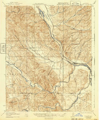
1919 Map of Bradley
USGS Topo · Published 1940About this map
The confluence of the Salinas River and its major tributaries, including the San Antonio River and Nacimiento River, defines the landscape of southern Monterey and northern San Luis Obispo counties during the early twentieth century. This era shows a valley system transitioning into a structured ranching and agricultural economy, anchored by the Southern Pacific Railroad corridor which serves stations like Bradley and the remote Getty Siding. The map records a network of country schools that once served these dispersed communities, from the Hames Valley School in the west to the Sargent School in the north.
Find a feature on this map
47 named features on this map. Tap any name to fly to it.
Don’t see what you’re looking for? This feature index may not catch every label — zoom into the map to look around manually.
Map Details
Editions of this 1919 Bradley Map
4 editions found
Other maps of this area

1912 · San Ardo
USGS Topo · 1:31,680

1915 · Priest Valley
USGS Topo · 1:125,000

1919 · San Miguel
USGS Topo · 1:62,500

1919 · King City
USGS Topo · 1:62,500

1919 · Bryson
USGS Topo · 1:62,500

1919 · Paso Robles
USGS Topo · 1:62,500

1919 · Bradley
USGS Topo · 1:62,500

1919 · Adelaida
USGS Topo · 1:62,500

1919 · San Simeon
USGS Topo · 1:62,500

1932 · Adelaida
USGS Topo · 1:62,500