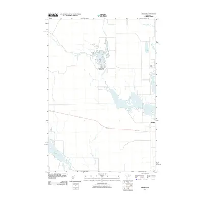
2010 Map of Bradley
USGS Topo · Published 2010About this map
Bradley serves as a primary point of reference in this Northwoods Wisconsin landscape, situated near the confluence of several significant waterways. The area is defined by its complex hydrology, featuring the Little Rice River which is controlled by the Little Rice River 2WP1331 Dam, creating a sprawling network of wetlands and flowages. This hydraulic engineering is central to the local geography, influencing the drainage patterns of nearby Brown Creek and Lund Creek.
Find a feature on this map
13 named features on this map. Tap any name to fly to it.
Don’t see what you’re looking for? This feature index may not catch every label — zoom into the map to look around manually.
Map Details
Editions of this 2010 Bradley Map
This is the sole edition of this map. No revisions or reprints were ever made.
Other maps of this area

1939 · Mc Cord
USGS Topo · 1:48,000

1939 · Cassian
USGS Topo · 1:48,000

1942 · Cassian
USGS Topo · 1:48,000

1947 · Mc Cord
USGS Topo · 1:48,000

1950 · Tomahawk
USGS Topo · 1:48,000

1950 · Spirit Falls
USGS Topo · 1:48,000

1952 · Spirit Falls
USGS Topo · 1:48,000

1952 · Tomahawk
USGS Topo · 1:48,000

1954 · Iron Mountain
USGS Topo · 1:250,000

1959 · Iron Mountain
USGS Topo · 1:250,000