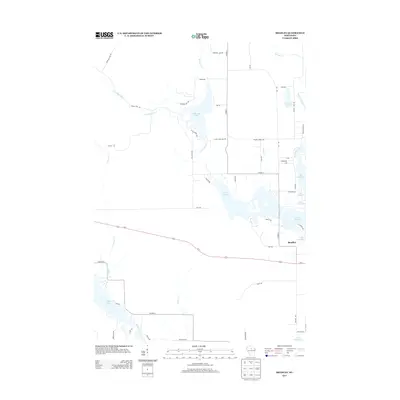
2013 Map of Bradley
USGS Topo · Published 2013About this map
The settlement of Bradley serves as a small hub in this lake-rich portion of Lincoln County, situated near the sprawling waters of Lake Nokomis. The landscape is defined by its complex hydrology, where the Tomahawk River and Little Rice River feed into numerous reservoirs and natural basins. Local infrastructure, such as Kelly Dam Rd and Somo Dam Dr, points to a history of water management and flow control across the region's many interconnected bodies of water, including Killarney Lake and Somo Lake.
Find a feature on this map
53 named features on this map. Tap any name to fly to it.
Don’t see what you’re looking for? This feature index may not catch every label — zoom into the map to look around manually.
Map Details
Editions of this 2013 Bradley Map
This is the sole edition of this map. No revisions or reprints were ever made.
Other maps of this area

1939 · Mc Cord
USGS Topo · 1:48,000

1939 · Cassian
USGS Topo · 1:48,000

1942 · Cassian
USGS Topo · 1:48,000

1947 · Mc Cord
USGS Topo · 1:48,000

1950 · Tomahawk
USGS Topo · 1:48,000

1950 · Spirit Falls
USGS Topo · 1:48,000

1952 · Spirit Falls
USGS Topo · 1:48,000

1952 · Tomahawk
USGS Topo · 1:48,000

1954 · Iron Mountain
USGS Topo · 1:250,000

1959 · Iron Mountain
USGS Topo · 1:250,000