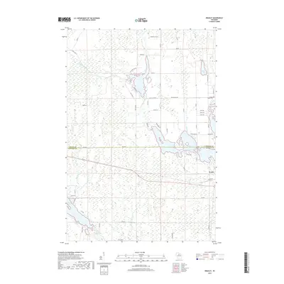
2018 Map of Bradley
USGS Topo · Published 2018About this map
The Bradley settlement and the winding Oneida Co Lincoln Co boundary define this north-central Wisconsin landscape. Much of the area is characterized by the complex hydrology of the Upper Wisconsin River basin, featuring the expansive Rice River Flowage and the connected waters of Bridge Lake. These water bodies, along with the Little Rice River and Somaduck River, highlight a region heavily shaped by flowages and timber-industry land management. Local history is anchored by the Prairie Rapids Cem, situated near the banks of the Somaduck River. The map details a network of rural routes and fire lanes, such as Kelly Fire Ln and Burrows Lake RD, which provide access to more remote areas like Somo Lake and Prairie Lake.
Find a feature on this map
62 named features on this map. Tap any name to fly to it.
Don’t see what you’re looking for? This feature index may not catch every label — zoom into the map to look around manually.
Map Details
Editions of this 2018 Bradley Map
This is the sole edition of this map. No revisions or reprints were ever made.
Other maps of this area

1939 · Mc Cord
USGS Topo · 1:48,000

1939 · Cassian
USGS Topo · 1:48,000

1942 · Cassian
USGS Topo · 1:48,000

1947 · Mc Cord
USGS Topo · 1:48,000

1950 · Tomahawk
USGS Topo · 1:48,000

1950 · Spirit Falls
USGS Topo · 1:48,000

1952 · Spirit Falls
USGS Topo · 1:48,000

1952 · Tomahawk
USGS Topo · 1:48,000

1954 · Iron Mountain
USGS Topo · 1:250,000

1959 · Iron Mountain
USGS Topo · 1:250,000