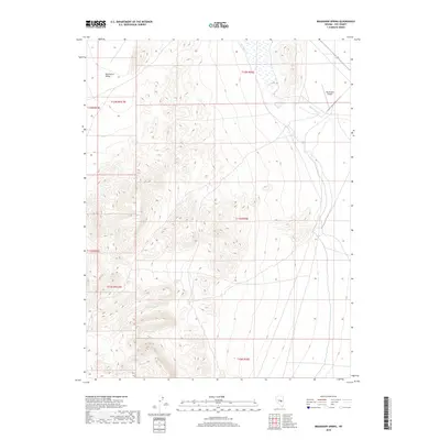
2018 Map of Bradshaw Spring
USGS Topo · Published 2018About this map
Bradshaw Spring and several other groundwater sources define the arid landscape of this Nye County quadrangle. Situated within the broader Duckwater Valley, the area shows a distinct pattern of hydraulic features that supported local survival and commerce in this high-desert environment. The presence of Indian Spring and Leeman Spring suggests a reliance on scattered water points for ranching or transit through the basin. Near the northeastern corner, Duckwater Cr flows through the terrain, adjacent to the Duckwater Airport. The map highlights the vastness of the valley, framed by Township and Range boundaries such as t12n r56e, and provides a detailed view of the natural drainage and land divisions that have organized this part of Nevada for generations.
Find a feature on this map
13 named features on this map. Tap any name to fly to it.
Don’t see what you’re looking for? This feature index may not catch every label — zoom into the map to look around manually.
Map Details
Editions of this 2018 Bradshaw Spring Map
This is the sole edition of this map. No revisions or reprints were ever made.
Other maps of this area

1956 · Lund
USGS Topo · 1:250,000

1960 · Lund
USGS Topo · 1:250,000

1964 · Blue Eagle Springs
USGS Topo · 1:62,500

1964 · Duckwater
USGS Topo · 1:62,500

1968 · Portuguese Mtn
USGS Topo · 1:62,500

1968 · Brown Summit
USGS Topo · 1:24,000
1968 · Sand Spring
USGS Topo · 1:24,000

1968 · Portuguese Mtn
USGS Topo · 1:24,000

1980 · Duckwater
USGS Topo · 1:100,000
1990 · Bradshaw Spring
USGS Topo · 1:24,000