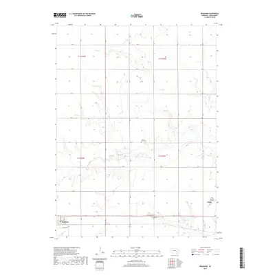
2017 Map of Bradshaw
USGS Topo · Published 2017About this map
The village of Bradshaw sits in the southwestern corner of this survey, serving as a hub for the surrounding agricultural grid of York County. The landscape is defined by the gentle drainage of Lincoln Cr and its tributary, Coon Br, which meander through a series of sections delineated by an extensive network of rural roads such as RD 21 and RD G. These watercourses provided the natural orientation for early settlement in the region, which is reflected here in the placement of the Lincoln Creek Cem near the creek's bank and the Bethesda Cem further south. Modern development is visible on the eastern edge near York, where the York Municipal Airport and the Carpenter Reservoir signify the expansion of the county seat’s infrastructure into the surrounding prairie.
Find a feature on this map
29 named features on this map. Tap any name to fly to it.
Don’t see what you’re looking for? This feature index may not catch every label — zoom into the map to look around manually.
Map Details
Editions of this 2017 Bradshaw Map
This is the sole edition of this map. No revisions or reprints were ever made.
Other maps of this area

1896 · Stromsburg
USGS Topo · 1:125,000

1898 · York
USGS Topo · 1:125,000

1899 · York
USGS Topo · 1:125,000

1955 · Fremont
USGS Topo · 1:250,000

1955 · Lincoln
USGS Topo · 1:250,000

1957 · Fremont
USGS Topo · 1:250,000

1957 · Lincoln
USGS Topo · 1:250,000

1958 · Fremont
USGS Topo · 1:250,000

1958 · Lincoln
USGS Topo · 1:250,000

1962 · Polk
USGS Topo · 1:24,000