
1962 Map of Polk
USGS Topo · Published 1964About this map
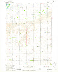
The Union Pacific railroad corridor anchors this early 1960s study of the Nebraska plains, dividing the northern agricultural townships from the meandering course of the Big Blue River. At the center of the grid, the town of Polk serves as the regional hub, characterized by its High Sch, a prominent Water Tank, and nearby Polk Cem. The landscape is defined by traditional township divisions like Pleasant Home and Otis, reflecting the late-19th-century settlement patterns of Polk, York, and Hamilton counties.
Find a feature on this map
24 named features on this map. Tap any name to fly to it.
Don’t see what you’re looking for? This feature index may not catch every label — zoom into the map to look around manually.
Map Details
Editions of this 1962 Polk Map
This is the sole edition of this map. No revisions or reprints were ever made.
Other maps of this area

1896 · Stromsburg
USGS Topo · 1:125,000

1898 · York
USGS Topo · 1:125,000

1899 · York
USGS Topo · 1:125,000

1955 · Fremont
USGS Topo · 1:250,000

1955 · Lincoln
USGS Topo · 1:250,000

1957 · Fremont
USGS Topo · 1:250,000

1957 · Lincoln
USGS Topo · 1:250,000

1958 · Fremont
USGS Topo · 1:250,000

1958 · Lincoln
USGS Topo · 1:250,000
1962 · Swedehome
USGS Topo · 1:24,000