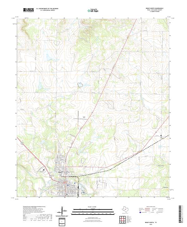
2022 Map of Brady North
USGS Topo · Published 2022About this map
Brady serves as the focal point of this McCulloch County survey, centered on the McCulloch County Courthouse and a dense network of local streets. The town's layout is defined by thoroughfares like N Bridge St and Depot St, while the surrounding landscape transitions into cattle country and water management projects. Notable hydrology includes Richards Park Reservoir on Brady Creek and a series of numbered catchments like Reservoir Number Fortyfive to the north. Local aviation history is represented by Curtis Field, and rural life is anchored by family-named sites and landmarks such as Gene Naumann Lake 1 and the Soldiers Water Hole Spring. The eastern edge of the map features the distinct terrain of Sweden Hollow and the East Sweden Cem, reflecting the area's heritage.
Find a feature on this map
94 named features on this map. Tap any name to fly to it.
Don’t see what you’re looking for? This feature index may not catch every label — zoom into the map to look around manually.
Map Details
Editions of this 2022 Brady North Map
This is the sole edition of this map. No revisions or reprints were ever made.
Other maps of this area

1894 · Brady
USGS Topo · 1:125,000

1928 · Mercury
USGS Topo · 1:62,500

1928 · Waldrip
USGS Topo · 1:62,500

1950 · Mercury
USGS Topo · 1:62,500

1954 · Brownwood
USGS Topo · 1:250,000

1960 · West Sweden
USGS Topo · 1:24,000

1960 · Brady North
USGS Topo · 1:24,000
1963 · Voca
USGS Topo · 1:24,000
1963 · Rochelle
USGS Topo · 1:24,000

1963 · Brady SW
USGS Topo · 1:24,000