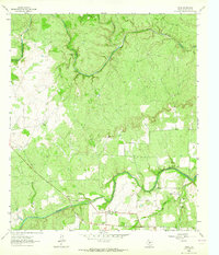
1963 Map of Voca
USGS Topo · Published 1964About this map
The San Saba River defines the southern landscape of this McCulloch County survey, winding through a region characterized by small-scale ranching and mineral extraction. The small settlement of Voca serves as a local hub, situated near several Quarry and Gravel Pit operations that suggest a late-century industrial footprint amidst the rural topography. Ranching interests are clearly marked by the Brook Ranch and Stephens Ranch, while the presence of a Brady Creek Lodge to the north points toward the area's utility for seasonal recreation or sporting. Genealogists will find the Spiller Cemetery and Liberty Church particularly significant for tracing local family histories. The reliance on natural water sources is evident through numerous flowing wells and a river ford near the mouth of Tiger Creek, showing how the local population navigated the waterway before extensive modern bridging.
Find a feature on this map
22 named features on this map. Tap any name to fly to it.
Don’t see what you’re looking for? This feature index may not catch every label — zoom into the map to look around manually.
Map Details
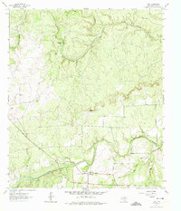
Editions of this 1963 Voca Map
2 editions found
Other maps of this area

1887 · Mason
USGS Topo · 1:125,000

1894 · Brady
USGS Topo · 1:125,000

1894 · Mason
USGS Topo · 1:125,000

1954 · Brownwood
USGS Topo · 1:250,000

1954 · Llano
USGS Topo · 1:250,000

1955 · Llano
USGS Topo · 1:250,000

1956 · Llano
USGS Topo · 1:250,000

1960 · Brady North
USGS Topo · 1:24,000
1962 · Fredonia
USGS Topo · 1:24,000

1963 · Spy Rock
USGS Topo · 1:24,000