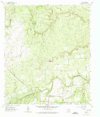
1963 Map of Voca
USGS Topo · Published 1974About this map
Voca serves as a small hub of activity in this 1960s landscape, situated south of the San Saba River. The area’s economic life is defined by natural resource extraction and ranching, evidenced by several Quarries and Gravel Pits dotting the terrain, alongside family-named holdings like Brook Ranch and Stephens Ranch. Social and genealogical landmarks are concentrated near the settlement, including the Liberty Ch and the Spiller Cem, providing valuable reference points for those tracing local history.
Find a feature on this map
17 named features on this map. Tap any name to fly to it.
Don’t see what you’re looking for? This feature index may not catch every label — zoom into the map to look around manually.
Map Details
Editions of this 1963 Voca Map
2 editions found
Other maps of this area

1887 · Mason
USGS Topo · 1:125,000

1894 · Brady
USGS Topo · 1:125,000

1894 · Mason
USGS Topo · 1:125,000

1954 · Brownwood
USGS Topo · 1:250,000

1954 · Llano
USGS Topo · 1:250,000

1955 · Llano
USGS Topo · 1:250,000

1956 · Llano
USGS Topo · 1:250,000

1960 · Brady North
USGS Topo · 1:24,000
1962 · Fredonia
USGS Topo · 1:24,000

1963 · Spy Rock
USGS Topo · 1:24,000