
1963 Map of Spy Rock
USGS Topo · Published 1964About this map
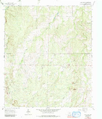
The San Saba River defines the northern edge of this landscape, where the border of Mc Culloch and Mason Counties cuts through a terrain of creeks and rocky landmarks. The area is characterized by family and community history markers such as Blackjack Cem, Wagram Cem, and Tabor Mountain Cem. Notable elevations like Tabor Mountain and Spy Rock rise above the drainage networks of Katemcy Creek, Tiger Creek, and Waterhole Creek. Small-scale industrial activity is evidenced by several Gravel Pits and Prospects scattered across the central hills. The map provides a detailed view of the rural infrastructure of the early 1960s, including a complex system of fence lines and unimproved roads connecting isolated ranching properties near Flat Rock and along Mud Creek.
Find a feature on this map
23 named features on this map. Tap any name to fly to it.
Don’t see what you’re looking for? This feature index may not catch every label — zoom into the map to look around manually.
Map Details
Editions of this 1963 Spy Rock Map
2 editions found
Other maps of this area

1887 · Mason
USGS Topo · 1:125,000

1894 · Brady
USGS Topo · 1:125,000

1894 · Mason
USGS Topo · 1:125,000

1954 · Brownwood
USGS Topo · 1:250,000

1954 · Llano
USGS Topo · 1:250,000

1955 · Llano
USGS Topo · 1:250,000

1956 · Llano
USGS Topo · 1:250,000

1962 · Purdy Hill
USGS Topo · 1:24,000
1962 · Fly Gap
USGS Topo · 1:24,000
1962 · Fredonia
USGS Topo · 1:24,000