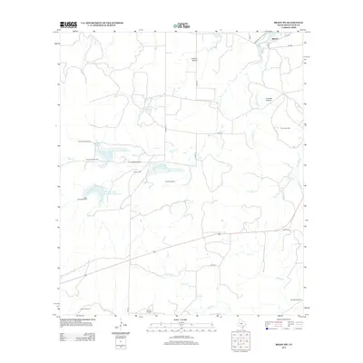
2013 Map of Brady SW
USGS Topo · Published 2013About this map
Brady Reservoir anchors the northern boundary of this McCulloch County landscape, where the southern outskirts of Brady meet a vast ranching and water management network. The terrain is defined by a sophisticated system of earthen dams, including Soil Conservation Service Site 4 Reservoir and Site 6, reflecting mid-century efforts to control runoff and manage water in this semi-arid region. Scattered across the draws and hollows are numerous named water sources essential to local livestock operations, such as Truman Windmill, Double Well Windmill, and Sulphur Windmill. The drainage patterns of Bear Cr and Little Bear Cr carve through the geography, while named landforms like Crooked Hollow and Fivemile Hollow provide clear markers for navigating the open country southwest of the county seat.
Find a feature on this map
35 named features on this map. Tap any name to fly to it.
Don’t see what you’re looking for? This feature index may not catch every label — zoom into the map to look around manually.
Map Details
Editions of this 2013 Brady SW Map
This is the sole edition of this map. No revisions or reprints were ever made.
Other maps of this area

1887 · Mason
USGS Topo · 1:125,000

1892 · Eden
USGS Topo · 1:125,000

1894 · Brady
USGS Topo · 1:125,000

1894 · Mason
USGS Topo · 1:125,000

1896 · Eden
USGS Topo · 1:125,000

1954 · Brownwood
USGS Topo · 1:250,000

1954 · Llano
USGS Topo · 1:250,000

1955 · Llano
USGS Topo · 1:250,000

1956 · Llano
USGS Topo · 1:250,000

1960 · West Sweden
USGS Topo · 1:24,000