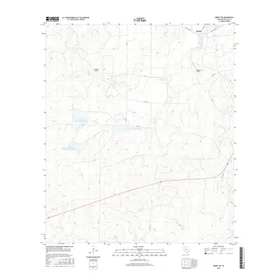
2016 Map of Brady SW
USGS Topo · Published 2016About this map
Brady anchors the northeast corner of this central Texas landscape, where the southern reaches of the Brady Reservoir meet a network of rural county roads. The terrain is defined by a series of drainage systems, including Crooked Hollow and Fivemile Hollow, which feed into numerous creeks such as Little Bear Cr and Bear Cr. A distinctive feature of this era is the managed water system, evidenced by several flood control structures like Soil Conservation Service Site 4 Reservoir and its counterparts, Site 5 and Site 6. These reservoirs, scattered across the ranchlands, illustrate modern efforts to mitigate erosion and manage runoff in the Edwards Plateau region. Tracing the paths of FM 1311 and Co RD 112 reveals the sparsely populated ranching character of McCulloch County, where the land is largely shaped by intermittent waterways like Hog Cr and Camp Cr.
Find a feature on this map
24 named features on this map. Tap any name to fly to it.
Don’t see what you’re looking for? This feature index may not catch every label — zoom into the map to look around manually.
Map Details
Editions of this 2016 Brady SW Map
This is the sole edition of this map. No revisions or reprints were ever made.
Other maps of this area

1887 · Mason
USGS Topo · 1:125,000

1892 · Eden
USGS Topo · 1:125,000

1894 · Brady
USGS Topo · 1:125,000

1894 · Mason
USGS Topo · 1:125,000

1896 · Eden
USGS Topo · 1:125,000

1954 · Brownwood
USGS Topo · 1:250,000

1954 · Llano
USGS Topo · 1:250,000

1955 · Llano
USGS Topo · 1:250,000

1956 · Llano
USGS Topo · 1:250,000

1960 · West Sweden
USGS Topo · 1:24,000