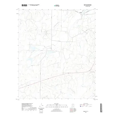
2019 Map of Brady SW
USGS Topo · Published 2019About this map
The town of Brady anchors the northern edge of this McCulloch County landscape, where the street grid of W 17th St gives way to the open ranch land of central Texas. This area is defined by a dense network of seasonal drainages and creek beds that have carved distinct geographic features such as Fivemile Hollow and Crooked Hollow. Water management is central to the local economy, evidenced by Reservoir Number Four and various private and county roads like Co Rd 112 that connect the dispersed ranching properties.
Find a feature on this map
30 named features on this map. Tap any name to fly to it.
Don’t see what you’re looking for? This feature index may not catch every label — zoom into the map to look around manually.
Map Details
Editions of this 2019 Brady SW Map
This is the sole edition of this map. No revisions or reprints were ever made.
Other maps of this area

1887 · Mason
USGS Topo · 1:125,000

1892 · Eden
USGS Topo · 1:125,000

1894 · Brady
USGS Topo · 1:125,000

1894 · Mason
USGS Topo · 1:125,000

1896 · Eden
USGS Topo · 1:125,000

1954 · Brownwood
USGS Topo · 1:250,000

1954 · Llano
USGS Topo · 1:250,000

1955 · Llano
USGS Topo · 1:250,000

1956 · Llano
USGS Topo · 1:250,000

1960 · West Sweden
USGS Topo · 1:24,000