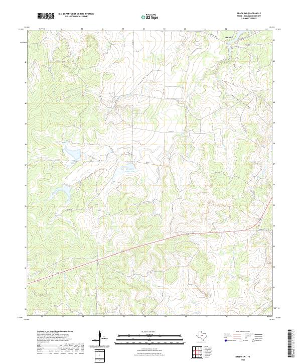
2022 Map of Brady SW
USGS Topo · Published 2022About this map
The northern reaches of Brady mark the upper edge of this McCulloch County landscape, where the terrain transitions into a complex system of drainages and seasonal watercourses. Central to the area is Reservoir Number Four, a focal point for local water management south of the city limits. The geography is defined by deep, winding cuts such as Crooked Hollow and Fivemile Hollow, which feed into a network of creeks including Bear Cr, Little Bear Cr, and Post Oak Cr. This 2022 survey illustrates the modern road network of the Texas Hill Country fringe, showing how Ranch Roads like Ranch Rd 2028 and various county roads navigate the undulating hills. The southern portion of the quadrangle remains largely open and rural, crisscrossed by Camp Cr and Rumsey Cr, reflecting the region's enduring ranching and agricultural character.
Find a feature on this map
29 named features on this map. Tap any name to fly to it.
Don’t see what you’re looking for? This feature index may not catch every label — zoom into the map to look around manually.
Map Details
Editions of this 2022 Brady SW Map
This is the sole edition of this map. No revisions or reprints were ever made.
Other maps of this area

1887 · Mason
USGS Topo · 1:125,000

1892 · Eden
USGS Topo · 1:125,000

1894 · Brady
USGS Topo · 1:125,000

1894 · Mason
USGS Topo · 1:125,000

1896 · Eden
USGS Topo · 1:125,000

1954 · Brownwood
USGS Topo · 1:250,000

1954 · Llano
USGS Topo · 1:250,000

1955 · Llano
USGS Topo · 1:250,000

1956 · Llano
USGS Topo · 1:250,000

1960 · West Sweden
USGS Topo · 1:24,000