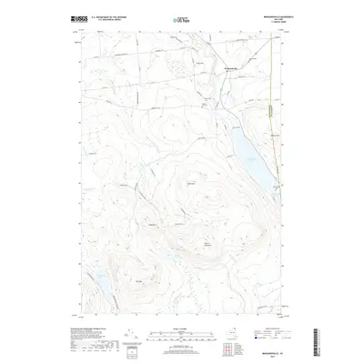
2019 Map of Brainardsville
USGS Topo · Published 2019About this map
Brainardsville serves as the primary settlement hub in this northern New York landscape, situated where the Chateaugay River flows toward the Canadian border. The area is defined by its transition from low-lying river valleys and Lower Chateaugay Lake in the east to the more prominent peaks of the Adirondack Park in the south, including Soulia Mtn and Baldy Mtn. The map reveals a high density of small family and community burial grounds, such as Bigelow Cem, Merrill Cem, and Bunker Hill Cem, which are invaluable for genealogical research in this rural pocket of Clinton and Franklin Counties. These sites, often positioned along early roads like Snow Schoolhouse Rd and Jericho Rd, suggest a long-established pattern of dispersed upland farming and mountain-side settlement characteristic of the northern Adirondack foothills.
Find a feature on this map
61 named features on this map. Tap any name to fly to it.
Don’t see what you’re looking for? This feature index may not catch every label — zoom into the map to look around manually.
Map Details
Editions of this 2019 Brainardsville Map
This is the sole edition of this map. No revisions or reprints were ever made.
Other maps of this area

1906 · Loon Lake
USGS Topo · 1:62,500

1908 · Loon Lake
USGS Topo · 1:62,500

1911 · Lyon Mountain
USGS Topo · 1:62,500

1913 · Lyon Mountain
USGS Topo · 1:62,500

1915 · Churubusco
USGS Topo · 1:62,500

1915 · Chateaugay
USGS Topo · 1:62,500

1931 · Lyon Mountain
USGS Topo · 1:62,500

1943 · Churubusco
USGS Topo · 1:62,500

1943 · Chateaugay
USGS Topo · 1:62,500

1948 · Ogdensburg
USGS Topo · 1:250,000