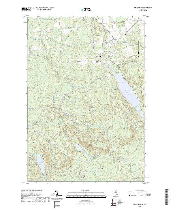
2023 Map of Brainardsville
USGS Topo · Published 2023About this map
Brainardsville serves as the primary settlement in this northern Franklin County landscape, situated where the Chateaugay River winds through high-elevation terrain. This 2023 survey delineates the boundary of the Adirondack Park, which encompasses prominent peaks such as Soulia Mountain and Baldy Mountain. The water network is particularly dense, featuring the Little Trout River, the Chateaugay Narrows, and the expansive Lower Chateaugay Lake. Local history is preserved through several family and community burial grounds, including the Merrill Cem, Bigelow Cem, and Bunker Hill Cem. The topography transitions from the lower river valleys to the high ridges of East Mountain and Figure Eight Mountain, with secluded water bodies like Figure Eight Pond and Ingraham Pond tucked away in the southern reaches. This modern map provides an essential baseline for tracking the continuity of small northern New York hamlets and their relationship with the protected wilderness.
Find a feature on this map
59 named features on this map. Tap any name to fly to it.
Don’t see what you’re looking for? This feature index may not catch every label — zoom into the map to look around manually.
Map Details
Editions of this 2023 Brainardsville Map
This is the sole edition of this map. No revisions or reprints were ever made.
Other maps of this area

1906 · Loon Lake
USGS Topo · 1:62,500

1908 · Loon Lake
USGS Topo · 1:62,500

1911 · Lyon Mountain
USGS Topo · 1:62,500

1913 · Lyon Mountain
USGS Topo · 1:62,500

1915 · Churubusco
USGS Topo · 1:62,500

1915 · Chateaugay
USGS Topo · 1:62,500

1931 · Lyon Mountain
USGS Topo · 1:62,500

1943 · Churubusco
USGS Topo · 1:62,500

1943 · Chateaugay
USGS Topo · 1:62,500

1948 · Ogdensburg
USGS Topo · 1:250,000