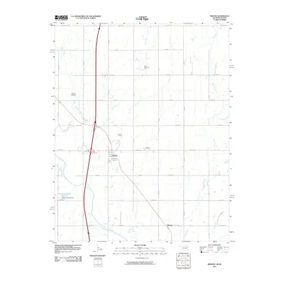
2010 Map of Braman
USGS Topo · Published 2010About this map
The town of Braman and the surrounding agricultural landscape of northern Kay County are defined here by a legacy of petroleum extraction and a network of prairie waterways. Extensive operations are visible through the Braman Oil Field, North Braman Oil Field, and Braman Northwest Oil Field, reflecting the industrial character of this region near the Kansas border. The terrain is drained by several meandering streams, including Shoo Fly Creek and Dry Creek, which flow toward the Chikaskia River at the southern edge of the survey.
Find a feature on this map
37 named features on this map. Tap any name to fly to it.
Don’t see what you’re looking for? This feature index may not catch every label — zoom into the map to look around manually.
Map Details
Editions of this 2010 Braman Map
This is the sole edition of this map. No revisions or reprints were ever made.
Other maps of this area

1890 · Wellington
USGS Topo · 1:125,000

1955 · Wichita
USGS Topo · 1:250,000

1955 · Enid
USGS Topo · 1:250,000

1958 · Enid
USGS Topo · 1:250,000

1958 · Wichita
USGS Topo · 1:250,000

1965 · Portland
USGS Topo · 1:24,000

1965 · South Haven
USGS Topo · 1:24,000

1965 · Geuda Springs
USGS Topo · 1:24,000

1967 · Braman
USGS Topo · 1:24,000

1968 · Blackwell NW
USGS Topo · 1:24,000