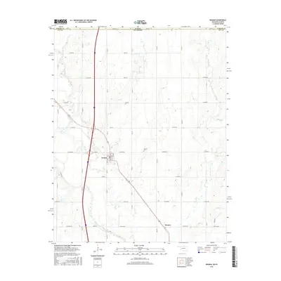
2016 Map of Braman
USGS Topo · Published 2016About this map
Braman serves as the primary hub in this northern Oklahoma landscape, situated just south of the Kansas Oklahoma state line. The town's grid is detailed with residential streets such as Broadway Ave, Kimmell Ave, and Clyde Ave, providing a clear view of the settlement's footprint in the modern era. To the east, the Braman Cem sits atop a rise, while further south lies Sumpter, marking a secondary point of interest for local history researchers. The geography is defined by a series of south-flowing drainage systems, most notably Shoo Fly Creek in the west and the various branches of Bitter Cr to the east. These waterways, including Scatter Cr and Dry Cr, weave through a network of section-line roads like W Braman and W Peckham Rd that reflect the enduring agricultural structure of Kay County.
Find a feature on this map
46 named features on this map. Tap any name to fly to it.
Don’t see what you’re looking for? This feature index may not catch every label — zoom into the map to look around manually.
Map Details
Editions of this 2016 Braman Map
This is the sole edition of this map. No revisions or reprints were ever made.
Other maps of this area

1890 · Wellington
USGS Topo · 1:125,000

1955 · Wichita
USGS Topo · 1:250,000

1955 · Enid
USGS Topo · 1:250,000

1958 · Enid
USGS Topo · 1:250,000

1958 · Wichita
USGS Topo · 1:250,000

1965 · Portland
USGS Topo · 1:24,000

1965 · South Haven
USGS Topo · 1:24,000

1965 · Geuda Springs
USGS Topo · 1:24,000

1967 · Braman
USGS Topo · 1:24,000

1968 · Blackwell NW
USGS Topo · 1:24,000