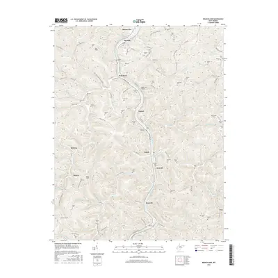
2016 Map of Branchland
USGS Topo · Published 2016About this map
The Guyandotte River carves a deep path through Lincoln County, serving as the central artery for a series of communities including Branchland, Midkiff, and Hubball. The geography is defined by a dense network of hollows and ridges, such as Stone Coal Hollow and McComas Ridge, where settlement patterns closely follow the winding creek beds and riverbanks. This 2016 survey illustrates the persistent rural character of the region, where family and community heritage is anchored by dozens of small burial grounds like Cartwright Cem and McCallister Cem. The landscape is a maze of local connectors such as Ten Mile Creek Rd and Riverview Ave, which link isolated points like Flag Knob and Bear Knob to the river corridor. This map provides a detailed view of the small-scale settlement patterns typical of the Appalachian plateau, documenting the location of schools, churches, and historic homesteads often missed in broader surveys.
Find a feature on this map
134 named features on this map. Tap any name to fly to it.
Don’t see what you’re looking for? This feature index may not catch every label — zoom into the map to look around manually.
Map Details
Editions of this 2016 Branchland Map
This is the sole edition of this map. No revisions or reprints were ever made.
Other maps of this area

1892 · Huntington
USGS Topo · 1:125,000

1898 · Huntington
USGS Topo · 1:125,000

1901 · Guyandot
USGS Topo · 1:62,500

1902 · Guyandot
USGS Topo · 1:62,500

1902 · Milton
USGS Topo · 1:62,500

1902 · Midkiff
USGS Topo · 1:62,500

1907 · Midkiff
USGS Topo · 1:62,500

1909 · Wayne
USGS Topo · 1:62,500

1909 · Midkiff
USGS Topo · 1:62,500

1931 · Wayne
USGS Topo · 1:62,500