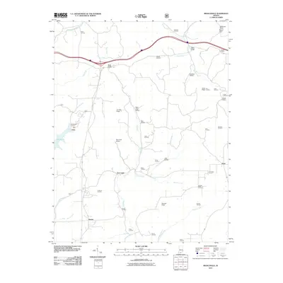
2010 Map of Branchville
USGS Topo · Published 2010About this map
Saint Croix and Branchville anchor this rural landscape in the Hoosier State, where a complex network of hollows and ridges defines the local geography. The area is exceptionally dense with family and community burial grounds, from the Rickenbaugh Cemetery near Lake Celina to the German Ridge Cemetery in the south, reflecting a deep-rooted history of local settlement. The terrain is marked by significant elevation features such as McKensie Ridge, where the West Fork Lookout Tower provides a high vantage point overlooking the drainage basins of Oil Creek and Ewing Creek. Small, dispersed settlements like Bandon and Oriole are connected by winding roads that navigate around landmarks like Peter Cave Hollow and Rich Cave Hollow. This map offers researchers a detailed view of the 21st-century rural infrastructure, preserving the names of remote locations like Happy Hollow and Goldman Hollow alongside vital water sources such as the Middle Fork Anderson River.
Find a feature on this map
75 named features on this map. Tap any name to fly to it.
Don’t see what you’re looking for? This feature index may not catch every label — zoom into the map to look around manually.
Map Details
Editions of this 2010 Branchville Map
This is the sole edition of this map. No revisions or reprints were ever made.
Other maps of this area

1950 · Beechwood
USGS Topo · 1:24,000

1950 · English
USGS Topo · 1:24,000

1950 · Alton
USGS Topo · 1:62,500

1950 · Alton
USGS Topo · 1:24,000

1951 · Alton
USGS Topo · 1:24,000

1954 · Derby
USGS Topo · 1:24,000

1956 · Taswell
USGS Topo · 1:24,000

1956 · Vincennes
USGS Topo · 1:250,000

1957 · Vincennes
USGS Topo · 1:250,000

1957 · Birdseye
USGS Topo · 1:24,000