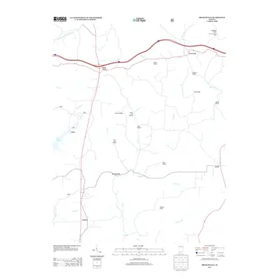
2013 Map of Branchville
USGS Topo · Published 2013About this map
Saint Croix and the village of Branchville anchor this study of the Perry County uplands, where the landscape is defined by a dense network of hollows and ridges. The topography is intricately carved by Oil Creek and its many tributaries, including Jubin Creek and Ewing Creek. This rural section of Indiana is characterized by small, dispersed settlements like Celina and Bandon, connected by winding roads that follow the natural contours of the land. High ground is marked by prominent landmarks such as German Ridge and Fairview Ridge, while the West Fork Lookout Tower on McKensie Ridge provides a strategic vantage point overlooking the Middle Fork Anderson River drainage. Near the western edge, Lake Celina offers a significant water feature amidst the timbered terrain, illustrating the region's balance of natural resource management and isolated rural life.
Find a feature on this map
33 named features on this map. Tap any name to fly to it.
Don’t see what you’re looking for? This feature index may not catch every label — zoom into the map to look around manually.
Map Details
Editions of this 2013 Branchville Map
This is the sole edition of this map. No revisions or reprints were ever made.
Other maps of this area

1950 · Beechwood
USGS Topo · 1:24,000

1950 · English
USGS Topo · 1:24,000

1950 · Alton
USGS Topo · 1:62,500

1950 · Alton
USGS Topo · 1:24,000

1951 · Alton
USGS Topo · 1:24,000

1954 · Derby
USGS Topo · 1:24,000

1956 · Taswell
USGS Topo · 1:24,000

1956 · Vincennes
USGS Topo · 1:250,000

1957 · Vincennes
USGS Topo · 1:250,000

1957 · Birdseye
USGS Topo · 1:24,000