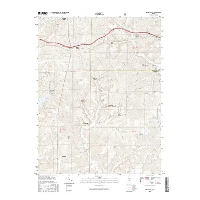
2016 Map of Branchville
USGS Topo · Published 2016About this map
Saint Croix and Branchville anchor this 2016 survey of the northern Crawford and Perry County line, where the terrain is defined by the winding drainages of the Hoosier National Forest. The landscape is heavily dissected by deep valleys and hollows, such as Peter Cave Hollow and Smith Hollow, which funnel water into Oil Creek and the Middle Fork Anderson River. This map is particularly valuable for genealogical research, as it documents a dense network of family and community burial grounds, including the Guillaume Cem, Luxenburger Cem, and Rickenbaugh Cem. Recreational and conservation interests are reflected in the presence of Lake Celina and the Two Lakes Trail 1, illustrating the transition of these wooded ridges into a managed natural resource area. Further north, the settlement of Doolittle Mills sits along the river, marking a point of long-standing local industry in this rugged portion of Southern Indiana.
Find a feature on this map
62 named features on this map. Tap any name to fly to it.
Don’t see what you’re looking for? This feature index may not catch every label — zoom into the map to look around manually.
Map Details
Editions of this 2016 Branchville Map
This is the sole edition of this map. No revisions or reprints were ever made.
Other maps of this area

1950 · Beechwood
USGS Topo · 1:24,000

1950 · English
USGS Topo · 1:24,000

1950 · Alton
USGS Topo · 1:62,500

1950 · Alton
USGS Topo · 1:24,000

1951 · Alton
USGS Topo · 1:24,000

1954 · Derby
USGS Topo · 1:24,000

1956 · Taswell
USGS Topo · 1:24,000

1956 · Vincennes
USGS Topo · 1:250,000

1957 · Vincennes
USGS Topo · 1:250,000

1957 · Birdseye
USGS Topo · 1:24,000