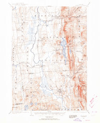
1902 Map of Brandon
USGS Topo · Published 1964About this map
Brandon serves as a principal hub in this 1902 survey, where the Rutland R. R. and the Addison Branch intersect near the Otter Creek valley. The map reveals a landscape defined by the sharp transition from the fertile lowlands of the Cedar Swamp to the rising elevations of the Green Mountains, featuring landmarks like Mt. Moosalamoo and Rattlesnake Point. Notable for genealogists and local historians, the sheet captures several distinct village centers, including Forestdale and Leicester Junction, alongside early resort life at Hyde Manor. The drainage of Lake Dunmore into the Leicester River illustrates the historical water power potential at the Falls of Lana. This survey documents a Vermont transition period, where agricultural communities and early tourism sites like Silver Lake were linked by an expanding rail network.
Find a feature on this map
74 named features on this map. Tap any name to fly to it.
Don’t see what you’re looking for? This feature index may not catch every label — zoom into the map to look around manually.
Map Details
Editions of this 1902 Brandon Map
2 editions found

Other maps of this area

1891 · Rutland
USGS Topo · 1:62,500

1893 · Rutland
USGS Topo · 1:62,500

1893 · Whitehall
USGS Topo · 1:62,500

1894 · Port Henry
USGS Topo · 1:62,500

1894 · Ticonderoga
USGS Topo · 1:62,500

1895 · Whitehall
USGS Topo · 1:62,500

1895 · Castleton
USGS Topo · 1:62,500

1896 · Ticonderoga
USGS Topo · 1:62,500

1897 · Castleton
USGS Topo · 1:62,500

1898 · Whitehall
USGS Topo · 1:62,500