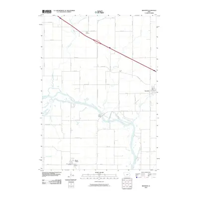
2010 Map of Brandon
USGS Topo · Published 2010About this map
The Cedar River meanders through this portion of Buchanan and Benton Counties, serving as a central geographic feature that defines the local landscape. The settlement of Brandon sits on the eastern edge of the quadrangle, supported by the Brandon Post Office. To the southwest, the community of Mount Auburn is situated near the riverbanks, featuring the Mount Auburn Post Office and the nearby Mount Auburn Cemetery.
Find a feature on this map
51 named features on this map. Tap any name to fly to it.
Don’t see what you’re looking for? This feature index may not catch every label — zoom into the map to look around manually.
Map Details
Editions of this 2010 Brandon Map
This is the sole edition of this map. No revisions or reprints were ever made.
Other maps of this area

1888 · Shellsburg
USGS Topo · 1:62,500

1889 · Shellsburg
USGS Topo · 1:62,500

1899 · Shellsburg
USGS Topo · 1:62,500

1903 · Winthrop
USGS Topo · 1:125,000

1954 · Waterloo
USGS Topo · 1:250,000

1955 · Waterloo
USGS Topo · 1:250,000

1959 · Dubuque
USGS Topo · 1:250,000

1961 · Dubuque
USGS Topo · 1:250,000

1962 · Dubuque
USGS Topo · 1:250,000
1968 · Center Point NW
USGS Topo · 1:24,000