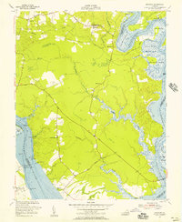
1952 Map of Brandon
USGS Topo · Published 1957About this map
Brandon sits prominently on the southern bank of the James River at the midpoint of this mid-century survey, surrounded by established landings and historical settlements in Charles City County. The landscape is defined by the heavy drainage patterns of Tomahund Creek and Morris Creek, which feed into the extensive marshes of the Chickahominy River to the east. Navigational aids like the Brandon Wharf Light and Ritchie Wharf Light reflect the ongoing maritime importance of the river corridor, while inland, the economy is marked by Clay Pits and Brick Kilns near Old Neck. Local social and community life is anchored by dispersed rural centers such as Binns Hall and Holderoft, each connected by a network of named roads including Binns Hall Road and Holderoft Road. Several houses of worship, including Mt Pleasant Ch, Mt Zion Ch, and Jerusalem Ch, appear alongside family-associated landmarks like Cherry Hall and The Row.
Find a feature on this map
46 named features on this map. Tap any name to fly to it.
Don’t see what you’re looking for? This feature index may not catch every label — zoom into the map to look around manually.
Map Details
Editions of this 1952 Brandon Map
This is the sole edition of this map. No revisions or reprints were ever made.
Other maps of this area

1917 · Toano
USGS Topo · 1:62,500

1918 · Charles City
USGS Topo · 1:62,500

1918 · Toano
USGS Topo · 1:62,500

1919 · Surry
USGS Topo · 1:62,500

1919 · Disputanta
USGS Topo · 1:62,500

1943 · Savedge
USGS Topo · 1:31,680

1943 · Richmond
USGS Topo · 1:250,000

1949 · Richmond
USGS Topo · 1:250,000
1952 · Norge
USGS Topo · 1:24,000
1953 · Toano
USGS Topo · 1:24,000