
1943 Map of Savedge
USGS Topo · Published 1943About this map
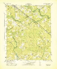
The Prince George County and Surry County line divides this mid-century landscape of agricultural crossroads and creek-fed industry. The area is defined by the winding course of Chippoak Creek and the tidal inlets of Wards Creek and Hundred Creek. Local commerce and community life center on small clusters like Burrowsville and Cabin Point, while the presence of the Lone Oak Grist Mill and several scattered Sawmills points to a rural economy still deeply tied to timber and grain processing. Numerous country churches, including Morning Star Church, Salem Church, and Gravel Hill Church, serve as the primary landmarks for the dispersed farmsteads. To the south, the settlement of Savedge anchors the corner of the map near United Temple, illustrating the traditional settlement patterns of the Virginia Tidewater region before modern development.
Find a feature on this map
23 named features on this map. Tap any name to fly to it.
Don’t see what you’re looking for? This feature index may not catch every label — zoom into the map to look around manually.
Map Details
Editions of this 1943 Savedge Map
This is the sole edition of this map. No revisions or reprints were ever made.
Other maps of this area

1917 · Toano
USGS Topo · 1:62,500

1918 · Charles City
USGS Topo · 1:62,500

1918 · Toano
USGS Topo · 1:62,500

1919 · Surry
USGS Topo · 1:62,500

1919 · Disputanta
USGS Topo · 1:62,500

1943 · Disputanta
USGS Topo · 1:31,680

1943 · Richmond
USGS Topo · 1:250,000

1944 · Waverly
USGS Topo · 1:31,680
1944 · Nebletts Mill
USGS Topo · 1:31,680
1947 · Nebletts Mills
USGS Topo · 1:25,000