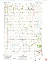
1980 Map of Brandon
USGS Topo · Published 1981About this map
The Chicago Milwaukee St Paul and Pacific railroad cuts a diagonal path through this agricultural landscape, linking the established village of Brandon with the community of Fairwater. The terrain is defined by the headwaters of the Rock River and the South Branch Rock River, which flow south across the Fond Du Lac Co / Dodge Co boundary. This area preserves a high density of rural cemeteries and family-named landmarks, such as Round Prairie Cem and Oak Mound Cem, reflecting the early settlement patterns of Metomen and Alto townships.
Find a feature on this map
46 named features on this map. Tap any name to fly to it.
Don’t see what you’re looking for? This feature index may not catch every label — zoom into the map to look around manually.
Map Details
Editions of this 1980 Brandon Map
This is the sole edition of this map. No revisions or reprints were ever made.
Other maps of this area

1916 · Ripon
USGS Topo · 1:48,000

1918 · Ripon
USGS Topo · 1:62,500

1955 · Waupun
USGS Topo · 1:62,500

1955 · Fox Lake
USGS Topo · 1:62,500

1956 · Ripon
USGS Topo · 1:62,500

1956 · Rosendale
USGS Topo · 1:62,500

1957 · Madison
USGS Topo · 1:250,000

1960 · Madison
USGS Topo · 1:250,000

1975 · Waupun NW
USGS Topo · 1:24,000
1975 · Waupun SW
USGS Topo · 1:24,000