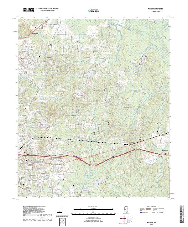
2024 Map of Brandon
USGS Topo · Published 2024About this map
Brandon serves as the focal point of this Rankin County survey, where the administrative core is clearly marked by the Rankin County Court and the Rankin County Justice Center. The landscape transition from the developed streets of Flowood in the northwest to the more dispersed settlements of Rankin and Pelahatchie in the east reveals a pattern of modern growth following the corridor of Interstate 20.
Find a feature on this map
232 named features on this map. Tap any name to fly to it.
Don’t see what you’re looking for? This feature index may not catch every label — zoom into the map to look around manually.
Map Details
Editions of this 2024 Brandon Map
This is the sole edition of this map. No revisions or reprints were ever made.
Other maps of this area

1903 · Jackson
USGS Topo · 1:125,000

1905 · Jackson
USGS Topo · 1:48,000

1906 · Florence
USGS Topo · 1:62,500

1908 · Jackson
USGS Topo · 1:62,500

1908 · Florence
USGS Topo · 1:62,500

1922 · Pelahatchee
USGS Topo · 1:48,000

1924 · Pelahatchee
USGS Topo · 1:62,500

1950 · Pelahatchie
USGS Topo · 1:62,500

1952 · Pelahatchie
USGS Topo · 1:62,500

1953 · Meridian
USGS Topo · 1:250,000