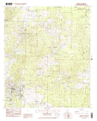
1982 Map of Brandon
USGS Topo · Published 1983About this map
The town of Brandon serves as the focal point of this 1980s-era study, situated along the vital corridor of the Illinois Central Gulf railroad. This landscape in Rankin County is characterized by a dense network of spiritual and educational landmarks, including numerous rural congregations such as True Vine Ch and Pilgrims Rest Ch. The surrounding terrain is heavily defined by its drainage systems, with Richland Creek and Pelahatchie Creek carving through the region, while the Northwest Rankin Attendance Center marks the growing infrastructure of the period.
Find a feature on this map
38 named features on this map. Tap any name to fly to it.
Don’t see what you’re looking for? This feature index may not catch every label — zoom into the map to look around manually.
Map Details
Editions of this 1982 Brandon Map
This is the sole edition of this map. No revisions or reprints were ever made.
Other maps of this area

1903 · Jackson
USGS Topo · 1:125,000

1905 · Jackson
USGS Topo · 1:48,000

1906 · Florence
USGS Topo · 1:62,500

1908 · Jackson
USGS Topo · 1:62,500

1908 · Florence
USGS Topo · 1:62,500

1922 · Pelahatchee
USGS Topo · 1:48,000

1924 · Pelahatchee
USGS Topo · 1:62,500

1950 · Pelahatchie
USGS Topo · 1:62,500

1952 · Pelahatchie
USGS Topo · 1:62,500

1953 · Meridian
USGS Topo · 1:250,000