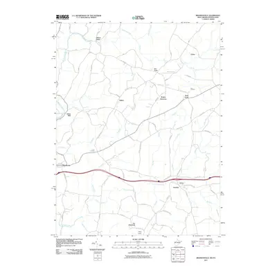
2011 Map of Brandonville
USGS Topo · Published 2011About this map
Clifton Mills and the surrounding borderlands of West Virginia and Pennsylvania are defined by a complex network of upland creeks and small agricultural settlements. The landscape is carved by Little Sandy Creek and its many tributaries, including Glade Run and Barnes Run, which dictate the placement of local roads like the Mason-Dixon Rd. This area reflects a long history of rural community life, marked by scattered hamlets such as Glade Farms and Gibbon Glade, and the presence of established burial grounds like Union Cemetery and Teets Cemetery. Notable for local historians are the locations of Wrights (historical) and Zar (historical), indicating former points of habitation or commerce. The southern portion of the map is anchored by Brandonville and Hazelton, where the Hazelton Post Office stands near the headwaters of Mill Run.
Find a feature on this map
79 named features on this map. Tap any name to fly to it.
Don’t see what you’re looking for? This feature index may not catch every label — zoom into the map to look around manually.
Map Details
Editions of this 2011 Brandonville Map
This is the sole edition of this map. No revisions or reprints were ever made.
Other maps of this area

1900 · Accident
USGS Topo · 1:62,500

1900 · Uniontown
USGS Topo · 1:62,500

1904 · Bruceton
USGS Topo · 1:62,500

1922 · Confluence
USGS Topo · 1:62,500

1926 · Bruceton
USGS Topo · 1:62,500

1931 · Uniontown
USGS Topo · 1:62,500

1931 · Confluence
USGS Topo · 1:62,500

1931 · Bruceton Mills
USGS Topo · 1:62,500

1933 · Confluence
USGS Topo · 1:62,500

1933 · Bruceton
USGS Topo · 1:62,500