
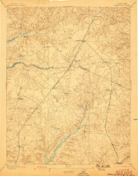
1895 Map of Brandywine
USGS Topo · Published 1895About this map
The dense wetlands of Zekiah Swamp dominate the southern landscape of this 1895 survey, which documents the rural interior of Southern Maryland before modern suburbanization. At the center of the region's commerce and transit, Brandywine serves as a critical junction for the Pope Creek Branch of the Baltimore and Potomac R. R. Many settlements are noted with dual identities, such as Malcolm (Woodville) and Duffield (Middletown), providing essential clues for genealogists tracing ancestral property.
Find a feature on this map
47 named features on this map. Tap any name to fly to it.
Don’t see what you’re looking for? This feature index may not catch every label — zoom into the map to look around manually.
Map Details
Editions of this 1895 Brandywine Map
2 editions found
Other maps of this area

1889 · Fredericksburg
USGS Topo · 1:125,000

1890 · Mt. Vernon
USGS Topo · 1:125,000

1891 · Mt. Vernon
USGS Topo · 1:125,000

1892 · Leonardtown
USGS Topo · 1:62,500

1892 · Fredericksburg
USGS Topo · 1:125,000

1892 · Prince Frederick
USGS Topo · 1:62,500

1892 · Brandywine
USGS Topo · 1:62,500

1892 · Owensville
USGS Topo · 1:62,500

1894 · Wicomico
USGS Topo · 1:62,500

1894 · Fredericksburg
USGS Topo · 1:125,000