Loading...
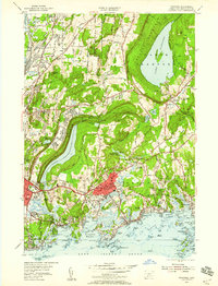
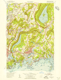
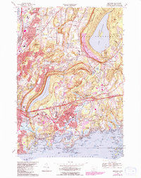
Loading map...1954 Map of Branford
USGS Topo · Published 1959About this map
Lake Gaillard and Lake Saltonstall dominate this mid-century view of the coastal landscape, carved by the Branford River and the Farm River as they flow toward Long Island Sound. The map documents the residential and industrial density of Branford and East Haven during a period of steady growth, showing the essential infrastructure of the New York New Haven and Hartford railroad line.
Find a feature on this map
120 named features on this map. Tap any name to fly to it.
Don’t see what you’re looking for? This feature index may not catch every label — zoom into the map to look around manually.
Map Details
Date Portrayed1954
Date Published1959
PublisherU.S. Geological Survey
Map TypeTopographic
Scale1:24,000
Physical Dimensions21.9 x 28.8 inches
Editions of this 1954 Branford Map
3 editions found

Historical Maps of New Haven Through Time
2 maps found
Featured Locations
Source Details
SourceU.S. Geological Survey
CopyrightPublic Domain