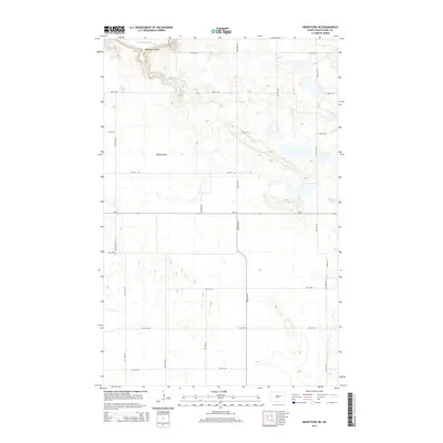
2014 Map of Brantford NE
USGS Topo · Published 2014About this map
The Sheyenne River winds through the northwestern corner of this landscape, carving a valley that includes the drainage of Robinson Coulee. This Eddy County region is characterized by a high concentration of small wetlands and prairie potholes, which become increasingly dense south of Tiffany Flats. The 2014 survey reveals a rigid section-line road grid, where routes like 18th St NE and 82nd Ave NE navigate around the scattered water bodies. The presence of Medicine Lake on the eastern edge highlights the area's natural hydrology, while the path of Nd-15 provides the primary east-west transit corridor through this agricultural heartland.
Find a feature on this map
20 named features on this map. Tap any name to fly to it.
Don’t see what you’re looking for? This feature index may not catch every label — zoom into the map to look around manually.
Map Details
Editions of this 2014 Brantford NE Map
This is the sole edition of this map. No revisions or reprints were ever made.
Other maps of this area

1928 · Tokio
USGS Topo · 1:62,500

1930 · Hamar
USGS Topo · 1:62,500

1931 · Tokio
USGS Topo · 1:62,500

1944 · Brantford
USGS Topo · 1:62,500

1946 · Brantford
USGS Topo · 1:62,500

1949 · Grace City
USGS Topo · 1:24,000

1950 · Brantford NW
USGS Topo · 1:24,000

1950 · Grace City
USGS Topo · 1:24,000

1950 · Brantford
USGS Topo · 1:24,000

1950 · Brantford NE
USGS Topo · 1:24,000