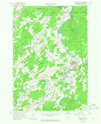
1964 Map of Brasher Falls
USGS Topo · Published 1966About this map
The St Regis River flows northward through the heart of this mid-1960s landscape, passing through the primary settlements of Brasher Falls and Winthrop. This period in St. Lawrence County shows a community organized around the river valley and a network of named country roads, such as Jenkins Corners Road and Munson Road. Extensive tracts of the St Lawrence State Forest dominate the northern and eastern reaches, while the interior is punctuated by numerous family-named burial grounds including Richardson Cem, Kyle Cem, and Holmes Hill Cem. Local education is centered at the St Lawrence Central Sch, while former industrial footprints are noted by an Abandoned railroad line. The map captures a detailed snapshot of rural life between Skinnerville and Stockholm Center, where small-scale gravel extraction and forestry operated alongside established river-side villages.
Find a feature on this map
48 named features on this map. Tap any name to fly to it.
Don’t see what you’re looking for? This feature index may not catch every label — zoom into the map to look around manually.
Map Details
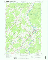
Editions of this 1964 Brasher Falls Map
2 editions found
Other maps of this area

1906 · Massena
USGS Topo · 1:62,500

1907 · Massena
USGS Topo · 1:62,500

1908 · Potsdam
USGS Topo · 1:62,500

1915 · Moira
USGS Topo · 1:62,500

1917 · Moira
USGS Topo · 1:62,500

1919 · Nicholville
USGS Topo · 1:62,500

1921 · Nicholville
USGS Topo · 1:62,500

1942 · Norfolk
USGS Topo · 1:24,000

1942 · Massena
USGS Topo · 1:24,000

1943 · Potsdam
USGS Topo · 1:31,680