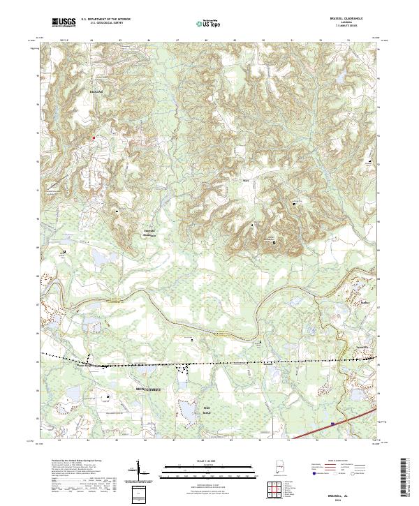
2024 Map of Brassell
USGS Topo · Published 2024About this map
The Tallapoosa River meanders across this landscape where Elmore, Montgomery, and Macon counties converge. This 2024 survey captures the evolving character of central Alabama, where suburban expansion from Montgomery and Pike Road meets the rural reaches of Shorter and Tysonville. The terrain is defined by low ridges like Sunset Ridge and Peter Hill, interspersed with an extensive network of waterways including Chubbehatchee Creek and Line Creek. For family historians, the map is particularly dense with legacy burial grounds, ranging from Billingslea Cem and Strahan Cem in the north to Hickory Bend Cem near the river. The presence of Mount Meigs Station and the Emerald Mountain Airport reflects the diverse transportation and infrastructure history of the region.
Find a feature on this map
92 named features on this map. Tap any name to fly to it.
Don’t see what you’re looking for? This feature index may not catch every label — zoom into the map to look around manually.
Map Details
Editions of this 2024 Brassell Map
This is the sole edition of this map. No revisions or reprints were ever made.
Other maps of this area

1901 · Wetumpka
USGS Topo · 1:125,000

1901 · Wetumpka
USGS Topo · 1:62,500

1903 · Wetumpka
USGS Topo · 1:125,000

1906 · Dadeville
USGS Topo · 1:125,000

1953 · Montgomery
USGS Topo · 1:250,000

1955 · Phenix City
USGS Topo · 1:250,000

1956 · Montgomery
USGS Topo · 1:250,000

1957 · Phenix City
USGS Topo · 1:250,000

1957 · Montgomery
USGS Topo · 1:250,000

1958 · Phenix City
USGS Topo · 1:250,000