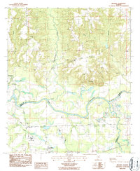
1987 Map of Brassell
USGS Topo · Published 1987About this map
The Tallapoosa River meanders sharply through this landscape, marking the transition between Elmore, Montgomery, and Macon counties. The map captures a moment in the late twentieth century when rural life and industrial extraction coexisted, evidenced by the numerous Gravel Pits and the Barrow Pit dotting the riverbanks. Several small settlements and rural crossroads are preserved here, including Old Bingham and Brassell, along with the Mount Meigs (Sta) railroad stop along the CSX line.
Find a feature on this map
36 named features on this map. Tap any name to fly to it.
Don’t see what you’re looking for? This feature index may not catch every label — zoom into the map to look around manually.
Map Details
Editions of this 1987 Brassell Map
This is the sole edition of this map. No revisions or reprints were ever made.
Other maps of this area

1901 · Wetumpka
USGS Topo · 1:125,000

1901 · Wetumpka
USGS Topo · 1:62,500

1903 · Wetumpka
USGS Topo · 1:125,000

1906 · Dadeville
USGS Topo · 1:125,000

1953 · Montgomery
USGS Topo · 1:250,000

1955 · Phenix City
USGS Topo · 1:250,000

1956 · Montgomery
USGS Topo · 1:250,000

1957 · Phenix City
USGS Topo · 1:250,000

1957 · Montgomery
USGS Topo · 1:250,000

1958 · Phenix City
USGS Topo · 1:250,000