1976 Map of Brawley
USGS Topo · Published 1980About this map
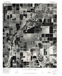
Brawley serves as the focal point of this 1976 orthophotoquad, which captures the Imperial Valley's agricultural intensity just as it appeared in the late 1970s. The aerial imagery reveals the rigid geometry of the surrounding irrigation network, essential for farming in this arid landscape. The New River carves a winding, riparian path from south to north, creating a stark visual contrast against the dark, rectangular patches of cultivated fields. Along the eastern side, the Dolson Drain channels water through the agricultural blocks, illustrating the complex hydraulic engineering required for the region's productivity. Major transportation arteries, including Highways 86, 111, and 78, converge at the city center, marking the town's role as a vital regional hub for the distribution of California's desert-grown crops.
Find a feature on this map
6 named features on this map. Tap any name to fly to it.
Don’t see what you’re looking for? This feature index may not catch every label — zoom into the map to look around manually.
Map Details
Editions of this 1976 Brawley Map
This is the sole edition of this map. No revisions or reprints were ever made.
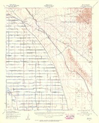
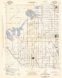
Other maps of this area

1907 · Holtville
USGS Topo · 1:125,000

1915 · El Centro
USGS Topo · 1:125,000

1940 · Brawley
USGS Topo · 1:62,500
1940 · Iris
USGS Topo · 1:62,500

1940 · Alamorio
USGS Topo · 1:62,500

1942 · El Centro
USGS Topo · 1:250,000

1943 · Brawley
USGS Topo · 1:62,500
1944 · Calipatria
USGS Topo · 1:62,500

1945 · Alamorio
USGS Topo · 1:62,500

1945 · Iris
USGS Topo · 1:62,500