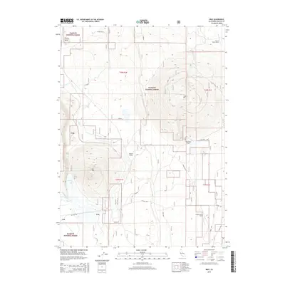
2015 Map of Bray
USGS Topo · Published 2015About this map
The high timber and volcanic terrain of Klamath National Forest defines this part of Siskiyou County, where historic railway and ranching outposts like Bray and Kegg sit along the former corridors of the Southern Pacific. The landscape is marked by prominent volcanic features including Jerome Butte and Cedar Mtn, while the seasonal hydrology of the region is evident in Orr Lake and the Antelope Sink. Local transportation is anchored by a network of forest and ranch roads such as Butte Creek Rd and the Old State Hwy. The presence of small aviation facilities like the Longbell Ranch Airport and Triple R Ranch Airport indicates the logistical challenges of this expansive territory. Surveying data reveals a complex grid of forest allotments and ranch boundaries, including the Garner Ranch and Round Valley, illustrating the intersection of federal land management and private agricultural use in the Cascades foothills.
Find a feature on this map
39 named features on this map. Tap any name to fly to it.
Don’t see what you’re looking for? This feature index may not catch every label — zoom into the map to look around manually.
Map Details
Editions of this 2015 Bray Map
This is the sole edition of this map. No revisions or reprints were ever made.
Other maps of this area

1886 · Modoc Lava Bed
USGS Topo · 1:250,000

1886 · Shasta
USGS Topo · 1:250,000

1892 · Modoc Lava-Bed
USGS Topo · 1:250,000

1894 · Shasta
USGS Topo · 1:250,000

1934 · Macdoel
USGS Topo · 1:96,000

1941 · Macdoel
USGS Topo · 1:125,000

1948 · Weed
USGS Topo · 1:250,000

1950 · Weed
USGS Topo · 1:250,000

1950 · Bray
USGS Topo · 1:62,500

1950 · Dorris
USGS Topo · 1:62,500