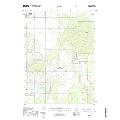
2018 Map of Bray
USGS Topo · Published 2018About this map
Bray and Kegg sit as the primary points of settlement in this high-elevation corner of the Klamath National Forest. The landscape is dominated by volcanic features and high-altitude drainage patterns, characterized by prominent peaks like Cedar Mtn, Jerome Butte, and Orr Mtn. These formations influence the local hydrology, where watercourses like Butte Cr and Horsethief Cr flow through valleys before reaching Orr Lake or disappearing into geological features like Antelope Sink. The infrastructure reveals a legacy of ranching and remote operations, evidenced by the Triple R Ranch Airport and Longbell Ranch Airport. Transportation is defined by a network of forest and access roads, including the Old State Hwy and the steep Orr Mountain Lookout Rd, which provides access to the heights above Round Valley.
Find a feature on this map
33 named features on this map. Tap any name to fly to it.
Don’t see what you’re looking for? This feature index may not catch every label — zoom into the map to look around manually.
Map Details
Editions of this 2018 Bray Map
This is the sole edition of this map. No revisions or reprints were ever made.
Other maps of this area

1886 · Modoc Lava Bed
USGS Topo · 1:250,000

1886 · Shasta
USGS Topo · 1:250,000

1892 · Modoc Lava-Bed
USGS Topo · 1:250,000

1894 · Shasta
USGS Topo · 1:250,000

1934 · Macdoel
USGS Topo · 1:96,000

1941 · Macdoel
USGS Topo · 1:125,000

1948 · Weed
USGS Topo · 1:250,000

1950 · Weed
USGS Topo · 1:250,000

1950 · Bray
USGS Topo · 1:62,500

1950 · Dorris
USGS Topo · 1:62,500