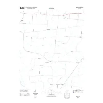
2013 Map of Brazil
USGS Topo · Published 2013About this map
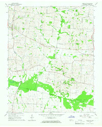
The crossroads community of Brazil serves as a central point in this West Tennessee landscape, where small rural settlements are linked by a network of family-named roads. The terrain is defined by the drainage of the Middle Fork Forked Deer River, with Buck Cr and Reagan Cr carving paths through the agricultural fields. Evidence of early community centers remains visible through the naming of areas like Spring Hill, Hickory Grove, and the uniquely named Frog Jump. To the south, Gibson Wells indicates the importance of local water sources, while the presence of Wilson Cem Rd and W H Bowers Lake provides specific points of interest for genealogists tracing local families and land ownership. The map illustrates a rural economy still tied to the land and the waterways that historically supported the region's development.
Find a feature on this map
65 named features on this map. Tap any name to fly to it.
Don’t see what you’re looking for? This feature index may not catch every label — zoom into the map to look around manually.
Map Details
Editions of this 2013 Brazil Map
This is the sole edition of this map. No revisions or reprints were ever made.
Other maps of this area

1951 · Trenton
USGS Topo · 1:24,000

1953 · Dyer
USGS Topo · 1:24,000

1956 · Dyersburg
USGS Topo · 1:250,000

1956 · Blytheville
USGS Topo · 1:250,000

1959 · Blytheville
USGS Topo · 1:250,000

1959 · Humboldt
USGS Topo · 1:24,000
1964 · Maury City
USGS Topo · 1:24,000
1964 · Alamo
USGS Topo · 1:24,000
1964 · Brazil
USGS Topo · 1:24,000
1964 · Yorkville
USGS Topo · 1:24,000