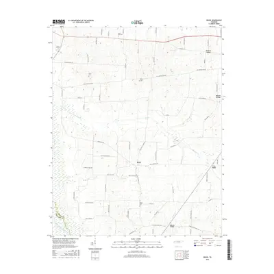
2016 Map of Brazil
USGS Topo · Published 2016About this map
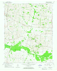
Brazil sits at the heart of this West Tennessee landscape, where a dense network of local roads connects several small farming communities. The terrain is defined by the meandering Middle Fork Forked Deer River along the southern border and the steady flow of Buck Cr and Reagan Cr through the center. This survey documents a quiet rural economy centered around crossroads settlements like Frog Jump and Gibson Wells. For those researching family history, the map provides precise locations for several neighborhood burial grounds, including Bowers Chapel Cem, Olive Branch Cem, and Spring Hill Cem. A notable geographic feature is the boundary line between Gibson Co and Crockett Co, which follows the southern river fork, illustrating how the natural waterway has historically shaped administrative divisions in the region.
Find a feature on this map
62 named features on this map. Tap any name to fly to it.
Don’t see what you’re looking for? This feature index may not catch every label — zoom into the map to look around manually.
Map Details
Editions of this 2016 Brazil Map
This is the sole edition of this map. No revisions or reprints were ever made.
Other maps of this area

1951 · Trenton
USGS Topo · 1:24,000

1953 · Dyer
USGS Topo · 1:24,000

1956 · Dyersburg
USGS Topo · 1:250,000

1956 · Blytheville
USGS Topo · 1:250,000

1959 · Blytheville
USGS Topo · 1:250,000

1959 · Humboldt
USGS Topo · 1:24,000
1964 · Maury City
USGS Topo · 1:24,000
1964 · Alamo
USGS Topo · 1:24,000
1964 · Brazil
USGS Topo · 1:24,000
1964 · Yorkville
USGS Topo · 1:24,000