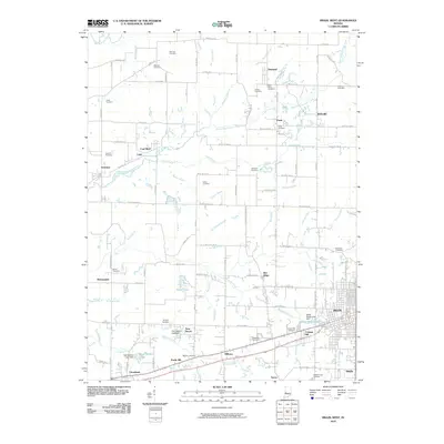
2010 Map of Brazil West
USGS Topo · Published 2010About this map
Brazil and its western outskirts appear in this contemporary survey, revealing a landscape defined by small named settlements and a high density of rural burial grounds. The western half of the city includes neighborhoods like Cottage Hill and Billtown, while the surrounding countryside is dotted with communities such as Diamond, Perth, and Coal Bluff. This region of Clay County is characterized by numerous small watercourses, including North Branch Otter Creek and Rio Grande Stream, which branch through a grid of county roads.
Find a feature on this map
106 named features on this map. Tap any name to fly to it.
Don’t see what you’re looking for? This feature index may not catch every label — zoom into the map to look around manually.
Map Details
Editions of this 2010 Brazil West Map
This is the sole edition of this map. No revisions or reprints were ever made.
Other maps of this area

1908 · Clay City
USGS Topo · 1:48,000

1910 · Clay City
USGS Topo · 1:62,500

1941 · Seelyville
USGS Topo · 1:24,000

1950 · Rosedale
USGS Topo · 1:24,000

1950 · Brazil East
USGS Topo · 1:24,000

1950 · Brazil West
USGS Topo · 1:24,000

1951 · Mecca
USGS Topo · 1:24,000

1951 · Mansfield
USGS Topo · 1:24,000

1952 · Catlin
USGS Topo · 1:24,000

1952 · Seelyville
USGS Topo · 1:24,000