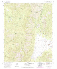
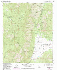
1972 Map of Breckenridge Mountain
USGS Topo · Published 1986About this map
Sequoia National Forest and the heights of Breckenridge Mountain dominate this landscape during the early 1970s, revealing a terrain utilized for both recreation and infrastructure. The summit area is marked by a concentration of communication sites, including Radio Tower (KERO) and Radio Tower (KBAK), alongside the Lookout Tower. Lower elevations to the east give way to the Walker Basin, where the Rankin Ranch and a nearby Cem suggest a legacy of local cattle ranching and settlement. The transition from timbered slopes to the more open Basin Creek drainage is documented through a network of specialized routes, including a firebreak and numerous pack trails. This survey captures the area just as the Tungsten Chief Mine and local water management features like Julia Lake and the Reservoir defined the local economy before later modern developments altered the access patterns.
Find a feature on this map
57 named features on this map. Tap any name to fly to it.
Don’t see what you’re looking for? This feature index may not catch every label — zoom into the map to look around manually.
Map Details
Editions of this 1972 Breckenridge Mountain Map
5 editions found
Other maps of this area

1906 · Kernville
USGS Topo · 1:125,000

1908 · Kernville
USGS Topo · 1:125,000

1914 · Caliente
USGS Topo · 1:125,000

1915 · Mojave
USGS Topo · 1:125,000

1920 · Delonagha
USGS Topo · 1:62,500

1926 · Glennville
USGS Topo · 1:62,500

1929 · Bena
USGS Topo · 1:31,680

1932 · Bena
USGS Topo · 1:31,680

1936 · Tobias Peak
USGS Topo · 1:125,000

1943 · Emerald Mtn
USGS Topo · 1:62,500