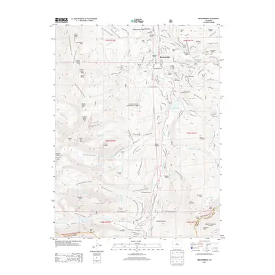
2013 Map of Breckenridge
USGS Topo · Published 2013About this map
The town of Breckenridge and its high-elevation surroundings are mapped here during the early 21st century, revealing a landscape defined by its mining heritage and its modern identity as a ski destination. Located within the White River National Forest, the map illustrates the transition from industrial extraction to recreation, with the Breckenridge Ski Area marked across the slopes of Peak 8 and Peak 7. The legacy of the area's pioneer days remains visible through the Valley Brook Cem and Breckenridge Masonic Cem, as well as named features like French Gulch and Gibson Hill.
Find a feature on this map
127 named features on this map. Tap any name to fly to it.
Don’t see what you’re looking for? This feature index may not catch every label — zoom into the map to look around manually.
Map Details
Editions of this 2013 Breckenridge Map
This is the sole edition of this map. No revisions or reprints were ever made.
Other maps of this area

1889 · Leadville
USGS Topo · 1:125,000

1891 · Leadville
USGS Topo · 1:125,000

1924 · Montezuma
USGS Topo · 1:62,500

1926 · Montezuma
USGS Topo · 1:62,500

1929 · Dillon
USGS Topo · 1:62,500

1933 · Montezuma
USGS Topo · 1:62,500

1934 · Climax
USGS Topo · 1:48,000

1934 · Dillon
USGS Topo · 1:62,500

1937 · Como
USGS Topo · 1:62,500

1938 · Mt. Lincoln
USGS Topo · 1:48,000