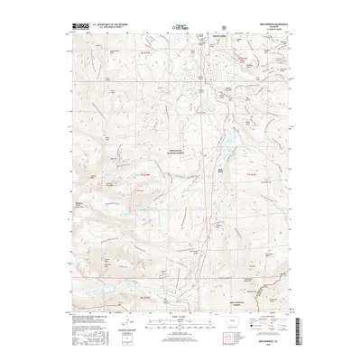
2016 Map of Breckenridge
USGS Topo · Published 2016About this map
Breckenridge serves as the focal point of this high-altitude survey, where the township meets the extensive outdoor recreation infrastructure of the Breckenridge Ski Area. The landscape is a complex network of historic mining legacy and modern preservation, featuring the Breckenridge Masonic Cem and Valley Brook Cem near the town's northern edge. The Blue River drainage dictates the topography, flowing through Goose Pasture Tarn and past several named gulches and hills that recall the area's prospecting roots, such as Gibson Hill and Barney Ford Hill. High-country engineering is evident in the presence of the Quandary Tunnel and Hoosier Pass Tunnel at the southern limits. Along the western divide, peaks like Crystal Peak and Father Dyer Peak overlook a chain of alpine water bodies including Upper Crystal Lake and the Mohawk Lake group, all connected by an intricate system of paths like the Wheeler National Recreation Trail.
Find a feature on this map
119 named features on this map. Tap any name to fly to it.
Don’t see what you’re looking for? This feature index may not catch every label — zoom into the map to look around manually.
Map Details
Editions of this 2016 Breckenridge Map
This is the sole edition of this map. No revisions or reprints were ever made.
Other maps of this area

1889 · Leadville
USGS Topo · 1:125,000

1891 · Leadville
USGS Topo · 1:125,000

1924 · Montezuma
USGS Topo · 1:62,500

1926 · Montezuma
USGS Topo · 1:62,500

1929 · Dillon
USGS Topo · 1:62,500

1933 · Montezuma
USGS Topo · 1:62,500

1934 · Climax
USGS Topo · 1:48,000

1934 · Dillon
USGS Topo · 1:62,500

1937 · Como
USGS Topo · 1:62,500

1938 · Mt. Lincoln
USGS Topo · 1:48,000