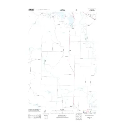
2013 Map of Breed
USGS Topo · Published 2013About this map
The South Branch Oconto River and North Branch Oconto River converge within this landscape of northern Wisconsin, anchoring a region defined by its waterway networks and dispersed rural settlements. This 2013 survey illustrates the community of Breed as a central junction along State Hwy 32, surrounded by small hamlets like Bonita and Logan. The terrain is punctuated by numerous water bodies, including Chute Pond, Anderson Lake, and Grignon Lake, which have long supported local recreation and seasonal camps. One such landmark, the U-Nah-Li-Ya Camp, sits near the northern edge of the map. Tracing the road network reveals a mix of state highways and local routes like Robenhorst Rd and Harris Rd, which connect the scattered homesteads and aviation facilities like Piso Airport to the broader Oconto County region.
Find a feature on this map
76 named features on this map. Tap any name to fly to it.
Don’t see what you’re looking for? This feature index may not catch every label — zoom into the map to look around manually.
Map Details
Editions of this 2013 Breed Map
This is the sole edition of this map. No revisions or reprints were ever made.
Other maps of this area

1942 · Breed
USGS Topo · 1:48,000

1952 · Langlade
USGS Topo · 1:48,000

1952 · Mountain
USGS Topo · 1:48,000

1954 · Shawano
USGS Topo · 1:48,000

1954 · Iron Mountain
USGS Topo · 1:250,000

1955 · Green Bay
USGS Topo · 1:250,000

1956 · Gillett
USGS Topo · 1:62,500

1959 · Iron Mountain
USGS Topo · 1:250,000

1964 · Shawano
USGS Topo · 1:62,500
1973 · Mountain
USGS Topo · 1:24,000