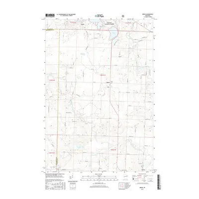
2015 Map of Breed
USGS Topo · Published 2015About this map
The North Branch Oconto River and South Branch Oconto River converge near the village of Suring, illustrating a landscape defined by its glacial hydrology and northern timber heritage. The northern portion of the map is dominated by the Nicolet National Forest, where water features like Chute Pond and Anderson Lake sit alongside smaller settlements such as Bonita. The transition from protected forest land to the agricultural and residential plots of Breed is marked by a network of rural roads, including Fire Lane 504 and St Joseph Church Rd. Local history is preserved in several community landmarks, including Union Cem, Riverside Cem, and the small Piso Airport. This 2015 survey reflects the enduring character of Oconto County, showing how modern land management and older river-based settlements continue to coexist.
Find a feature on this map
83 named features on this map. Tap any name to fly to it.
Don’t see what you’re looking for? This feature index may not catch every label — zoom into the map to look around manually.
Map Details
Editions of this 2015 Breed Map
This is the sole edition of this map. No revisions or reprints were ever made.
Other maps of this area

1942 · Breed
USGS Topo · 1:48,000

1952 · Langlade
USGS Topo · 1:48,000

1952 · Mountain
USGS Topo · 1:48,000

1954 · Shawano
USGS Topo · 1:48,000

1954 · Iron Mountain
USGS Topo · 1:250,000

1955 · Green Bay
USGS Topo · 1:250,000

1956 · Gillett
USGS Topo · 1:62,500

1959 · Iron Mountain
USGS Topo · 1:250,000

1964 · Shawano
USGS Topo · 1:62,500
1973 · Mountain
USGS Topo · 1:24,000