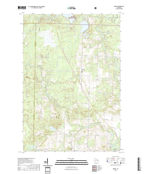
2022 Map of Breed
USGS Topo · Published 2022About this map
The Nicolet National Forest dominates the northern reaches of this landscape, where the South Branch Oconto River and its tributaries like Pecore Creek and Hayes Cr carve through the glacial terrain of Oconto County. Small settlements such as Breed and Bonita anchor the rural road network, while Suring sits at the southeastern edge along the river. The area is characterized by a high density of small lakes and ponds, including Chute Pond and Anderson Lake, reflecting the post-glacial hydrography typical of this region of Wisconsin.
Find a feature on this map
71 named features on this map. Tap any name to fly to it.
Don’t see what you’re looking for? This feature index may not catch every label — zoom into the map to look around manually.
Map Details
Editions of this 2022 Breed Map
This is the sole edition of this map. No revisions or reprints were ever made.
Other maps of this area

1942 · Breed
USGS Topo · 1:48,000

1952 · Langlade
USGS Topo · 1:48,000

1952 · Mountain
USGS Topo · 1:48,000

1954 · Shawano
USGS Topo · 1:48,000

1954 · Iron Mountain
USGS Topo · 1:250,000

1955 · Green Bay
USGS Topo · 1:250,000

1956 · Gillett
USGS Topo · 1:62,500

1959 · Iron Mountain
USGS Topo · 1:250,000

1964 · Shawano
USGS Topo · 1:62,500
1973 · Mountain
USGS Topo · 1:24,000